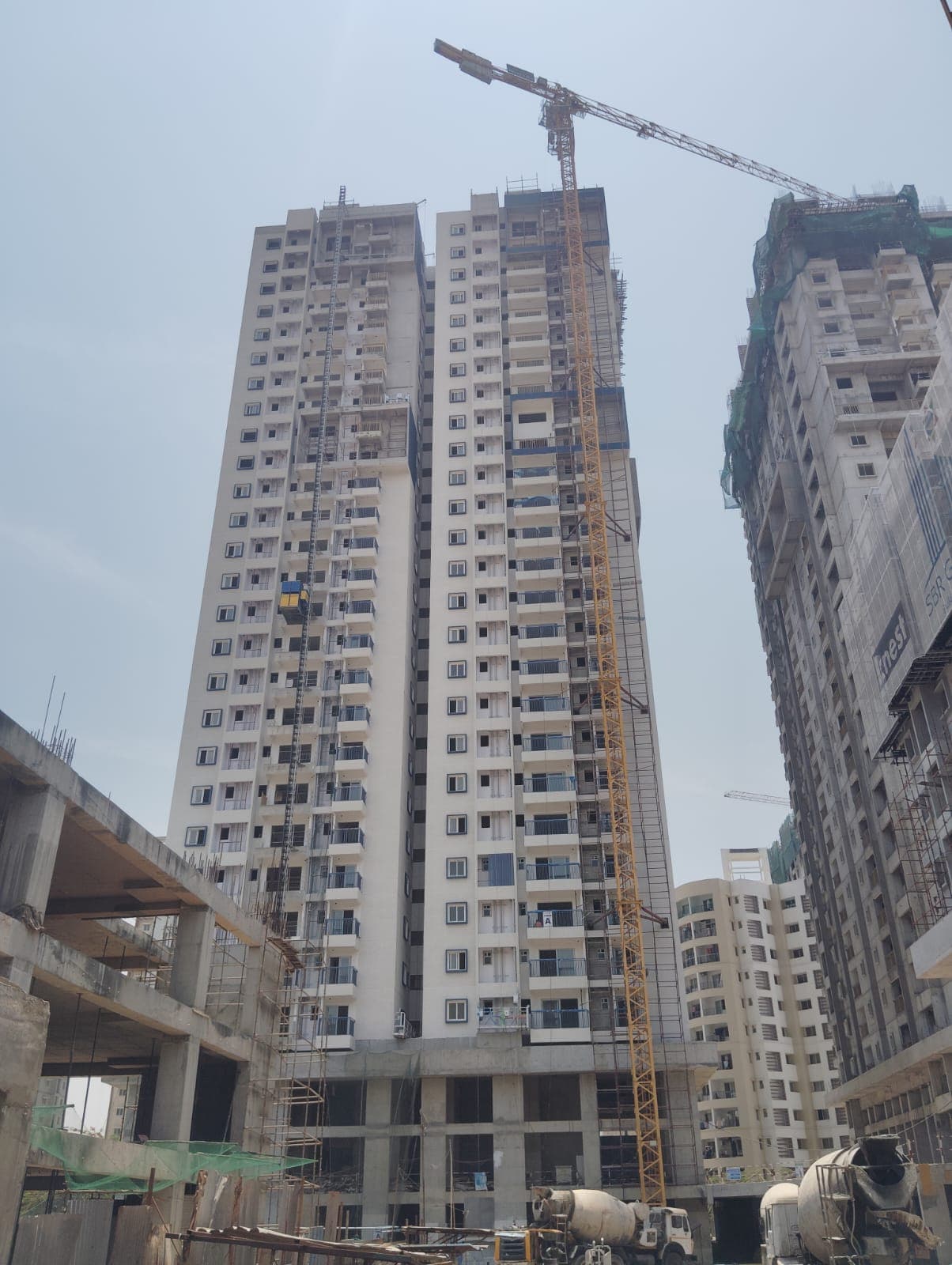
I had a disappointing experience with this builder. Price was changed later after finalising and email confirmation. They offered me a lower floor unit at same price. No response from builder side after I requested a cancellation. Somehow…
AAyush Jain19 May 2026★★★★★
Not responsive and very bad CRM team. The construction hasn't progressed for last 6 months. And management doesn't have any response for that. They also released demand notice prior to construction of the relevant floors. They are making…
PPiyush Khetan8 Feb 2026★★★★★
This property is indeed at the prime location but the response from the crm and management is very very poor. Even after writing multiple mails and follow-ups no one is bothered to respond back. Other than the word. ‘ we will get back to…
Map of drains, lakes, metro, high-tension lines and government-flagged flood locations within 3 km of the filed pin, with rings at 3 km. Approximate location: the filed pin, good to the neighbourhood, not the plot. The dashed ring is 1 km: of the approximate pins that could be checked against the surveyed land, nine in ten sat within it.
Storm drain, primary
Lake or tank
Metro lines (dashed: planned)
Metro station
High-tension line, 765, 400, 220 and 66 kV
Its corridor, to scale
Buried cable
Government-flagged flood location
Approximate location: the filed pin, good to the neighbourhood, not the plot
Everything here is as filed by the promoter with Karnataka RERA or as recorded in Bhoomi land records, and can be stale or wrong at source. Verify against certified records before you transact. Open Sbr Minara in the interactive atlas
•• ••• ••••
Title
Title report
•• %
•• ••• ••••
•••••
₹ •.•• Cr
Charges
•• ••• ••••
•••••
₹ •.•• Cr
•• of ••
Boundaries
Schedule in the EC vs KGIS neighbours
Not verified yet
Encumbrance certificate, Form 15
Survey sketch
Survey sketch filed with K-RERA
Not verified yet
Sketch, sanction and mutation vs KGIS map
Not verified yet
Land record
Survey plots · KGIS cadastral
Filing vs KGIS map
•• ••• ••••
•••••
₹ •.•• Cr
•• of ••
The RTC of each filed survey
Not verified yet
Ownership
Share of sales revenue
Not verified yet
Joint development agreement
•• of ••
₹ ••,•••
•• %
•• ••• ••••
Unlock this full report
₹99 for this report opens Contract & costs, Title & ownership, Disputes & cases and Documents for this project, yours to read for good.
Power lines, drains and flood locations around the filed pin
Basemap: Esri, OpenStreetMap contributors
Map of high-tension power lines, storm drains and government-flagged flood locations within about 2 km of an approximate filed pin. Approximate location: the filed pin, good to the neighbourhood, not the plot. The dashed ring is 1 km: of the approximate pins that could be checked against the surveyed land, nine in ten sat within it.
High-tension line, 765, 400, 220 and 66 kV
Its corridor, to scale
Buried cable
Storm drain, primary
Government-flagged flood location
Approximate location: the filed pin, good to the neighbourhood, not the plot
Map of storm drains, lakes and government-flagged flood locations within about 2 km of an approximate filed pin. Approximate location: the filed pin, good to the neighbourhood, not the plot. The dashed ring is 1 km: of the approximate pins that could be checked against the surveyed land, nine in ten sat within it.
Lake or tank
Storm drain, primary
Government-flagged flood location
Approximate location: the filed pin, good to the neighbourhood, not the plot
Across Bengaluru East, the water table sat 27.3 m below ground in July 2023 (KSNDMC, a taluk average), shallower than the ten-year July mean of 30.5 m, and it recovered 1.9 m over the year.
Water at a glance
Groundwater
Bengaluru East taluk average, July 2023: 27.3 m below ground
What it means
Not verified yet
Water below ground
27.3 m, the taluk average
Through the year
Not verified yet
Water supply, as filed
Borewell, Local authority (Seegehalli Gramapanchayath)
Nearest city water main
Not verified yet
Distances
Within 3 km of the filed pin
Basemap: Esri, OpenStreetMap contributors
Map of drains, lakes, metro, high-tension lines and government-flagged flood locations within 3 km of the filed pin, with rings at 3 km. Approximate location: the filed pin, good to the neighbourhood, not the plot. The dashed ring is 1 km: of the approximate pins that could be checked against the surveyed land, nine in ten sat within it.
Storm drain, primary
Lake or tank
Metro lines (dashed: planned)
Metro station
High-tension line, 765, 400, 220 and 66 kV
Its corridor, to scale
Buried cable
Government-flagged flood location
Approximate location: the filed pin, good to the neighbourhood, not the plot
 Photo: Manoj Mahala