Map of drains, lakes, metro, high-tension lines and government-flagged flood locations within 3 km of the filed pin, with rings at 3 km. Approximate location: the filed pin, good to the neighbourhood, not the plot. The dashed ring is 1 km: of the approximate pins that could be checked against the surveyed land, nine in ten sat within it.
Storm drain, primary
Storm drain, smaller
Lake or tank
Metro lines (dashed: planned)
Metro station
High-tension line, 765, 400, 220 and 66 kV
Its corridor, to scale
Buried cable
Government-flagged flood location
Approximate location: the filed pin, good to the neighbourhood, not the plot
Everything here is as filed by the promoter with Karnataka RERA or as recorded in Bhoomi land records, and can be stale or wrong at source. Verify against certified records before you transact. Open Poorvi Enchanting in the interactive atlas
•• ••• ••••
Title
Title report
•• %
•• ••• ••••
•••••
₹ •.•• Cr
Charges
•• ••• ••••
•••••
₹ •.•• Cr
•• of ••
Boundaries
Schedule in the EC vs KGIS neighbours
Not verified yet
Encumbrance certificate, Form 15
Survey sketch
Survey sketch filed with K-RERA
Not verified yet
Sketch, sanction and mutation vs KGIS map
Not verified yet
Land record
Survey plots · KGIS cadastral
Filing vs KGIS map
•• ••• ••••
•••••
₹ •.•• Cr
•• of ••
The RTC of each filed survey
Not verified yet
Ownership
Share of sales revenue
Not verified yet
Joint development agreement
•• of ••
₹ ••,•••
•• %
•• ••• ••••
Unlock this full report
₹99 for this report opens Contract & costs, Title & ownership, Disputes & cases and Documents for this project, yours to read for good.
Power lines, drains and flood locations around the filed pin
Basemap: Esri, OpenStreetMap contributors
Map of high-tension power lines, storm drains and government-flagged flood locations within about 2 km of an approximate filed pin. Approximate location: the filed pin, good to the neighbourhood, not the plot. The dashed ring is 1 km: of the approximate pins that could be checked against the surveyed land, nine in ten sat within it.
High-tension line, 765, 400, 220 and 66 kV
Its corridor, to scale
Buried cable
Storm drain, primary
Storm drain, smaller
Government-flagged flood location
Approximate location: the filed pin, good to the neighbourhood, not the plot
Drains, lakes and flood locations around the filed pin
Basemap: Esri, OpenStreetMap contributors
Map of storm drains, lakes and government-flagged flood locations within about 2 km of an approximate filed pin. Approximate location: the filed pin, good to the neighbourhood, not the plot. The dashed ring is 1 km: of the approximate pins that could be checked against the surveyed land, nine in ten sat within it.
Lake or tank
Storm drain, primary
Storm drain, smaller
Government-flagged flood location
Approximate location: the filed pin, good to the neighbourhood, not the plot
Electricity · CCTV Surveillance · Community Hall · Indoor Sports facility · Gym · Power Backup · Water and Sanitation
Electricity, built
100%
Community Hall, built
100%
Indoor Sports facility, built
100%
Gym, built
100%
Power Backup, built
100%
Water and Sanitation, built
100%
Kitchen handover
Not verified yet
Covered parking per unit
0.00 (0 covered spaces for 99 units)
Sewage plant
Not verified yet
Power backup
Declared by the promoter
Around it
Water
Groundwater, Bengaluru East taluk average
Ten-year July mean for this taluk: 30.5 m
Across Bengaluru East, the water table sat 27.3 m below ground in July 2023 (KSNDMC, a taluk average), shallower than the ten-year July mean of 30.5 m, and it recovered 1.9 m over the year.
Water at a glance
Groundwater
Bengaluru East taluk average, July 2023: 27.3 m below ground
What it means
Not verified yet
Water below ground
27.3 m, the taluk average
Through the year
Not verified yet
Water supply, as filed
Local authority (Halanayakanahlli Grama Panchyathi)
Nearest city water main
Not verified yet
Distances
Within 3 km of the filed pin
Connectivity
Road distance from the site
Nuisances
Distance from the filed pin
Not verified yet
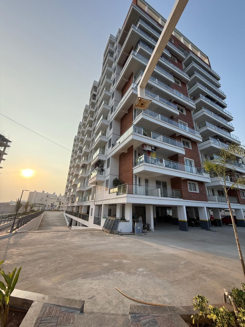
Site photos filed with K-RERA, Q3 2025-26
Work left
By component, Q3 2025-26
Quarterly return, Q3 2025-26
Main structure
100% · planned by 1 Jan 2024
Electrical and plumbing finishing
100% · planned by 1 Oct 2024
Internal roads
Not verified yet
Club house
Not verified yet
Completion
100%
Completion, accountant
Not verified yet
Dates
Dates
Filed dates
Possession, agreement
25 Nov 2024
Schedule end
1 Oct 2024
RERA completion date
25 Nov 2025
Work began, as filed
1 Jan 2023
Specified structure
What the promoter specified · not an inspection
Structure
Not verified yet
Foundation
Not verified yet
Wall material
Not verified yet
Wall thickness
Not verified yet
Concrete / steel grade
Not verified yet
Building heights, fire NOC
39.15 m on the fire NOC · 39.15 m filed
Specification sheet, page 1
Page 1
Page 1 of the specification sheet. The promoter filed this with the registration.
Map of drains, lakes, metro, high-tension lines and government-flagged flood locations within 3 km of the filed pin, with rings at 3 km. Approximate location: the filed pin, good to the neighbourhood, not the plot. The dashed ring is 1 km: of the approximate pins that could be checked against the surveyed land, nine in ten sat within it.
Storm drain, primary
Storm drain, smaller
Lake or tank
Metro lines (dashed: planned)
Metro station
High-tension line, 765, 400, 220 and 66 kV
Its corridor, to scale
Buried cable
Government-flagged flood location
Approximate location: the filed pin, good to the neighbourhood, not the plot
 Photo: HP Maity